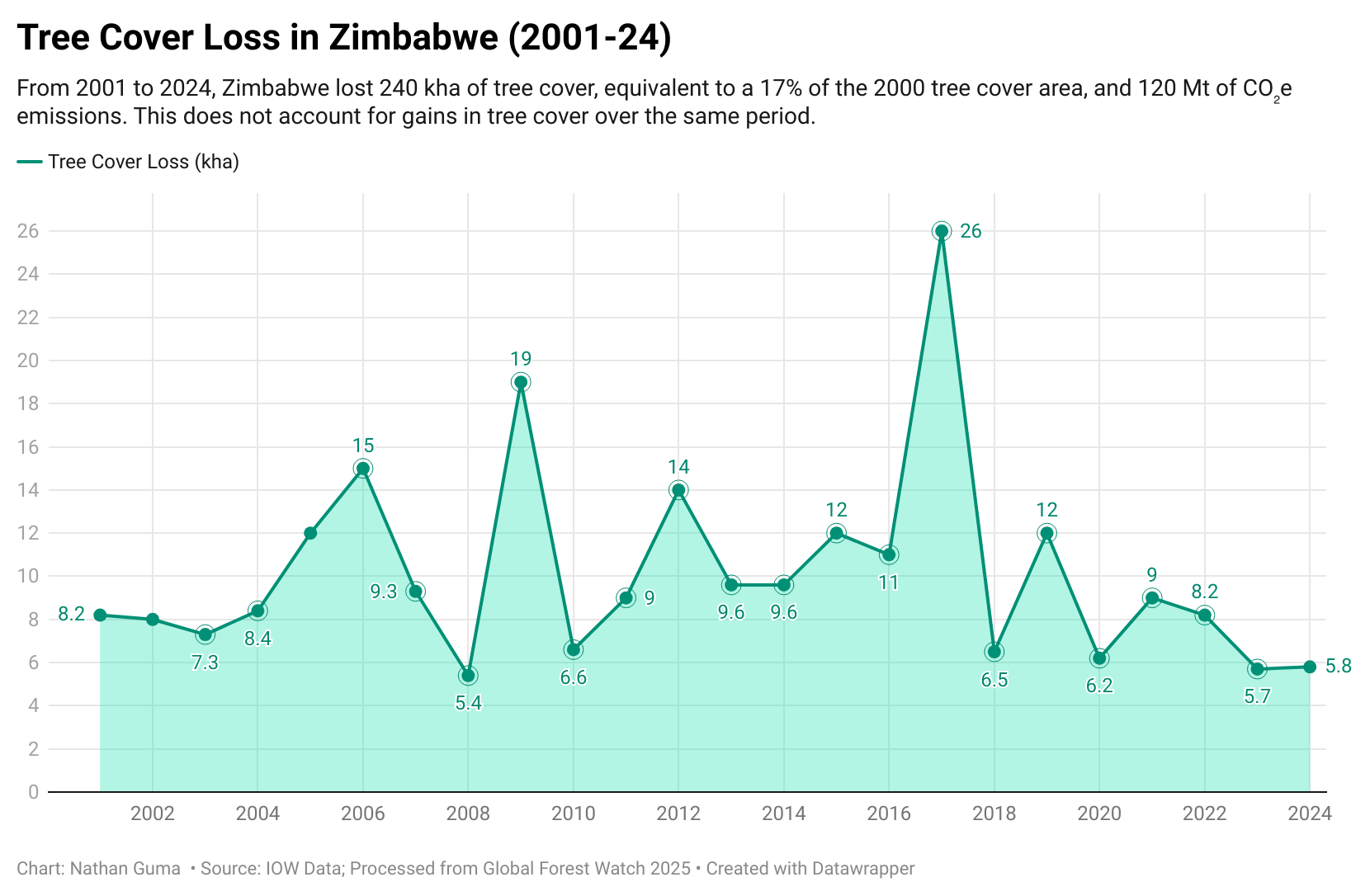
ZIMBABWE has experienced fluctuating tree cover loss due to fires between 2001 and 2024, with notable peaks reflecting changing environmental pressures, data from Global Forest Watch show.
From 2001 to 2024, Zimbabwe lost 3.6 kilohectares (kha) of tree cover from fires and 240 kha from all other drivers of loss.
The data, produced by the Global Land Analysis & Discovery (GLAD) Lab at the University of Maryland, measure areas of tree cover loss due to fires compared to other drivers across global land at approximately 30 × 30-metre resolution.
The dataset was generated using global Landsat-based annual change detection metrics for 2001–2020 as input to regionally calibrated classification tree ensemble models.
Tree cover is defined as all vegetation taller than five metres and may include natural forests or plantations across a range of canopy densities.
The year with the highest tree cover loss due to fires was 2009, when 570 ha were lost – 3.0% of all tree cover loss that year.
In Zimbabwe, the peak fire season typically begins in late July and lasts about 15 weeks.
Between 28 October 2024 and 3 November 2025, 5,951 VIIRS fire alerts were recorded, considering only high-confidence alerts, a figure that is unusually high compared to previous years, dating back to 2012.
The country also lost 1.0 kha of humid primary forest between 2002 and 2024, representing 0.43% of total tree cover loss, with the total area of humid primary forest decreasing by 13% over the same period.
During the review period, 52% of tree cover loss occurred in areas where deforestation was the dominant driver. Tree cover loss may result from human activities such as timber harvesting and land conversion, or from natural causes including fires, storms, and disease. – IOW Data.